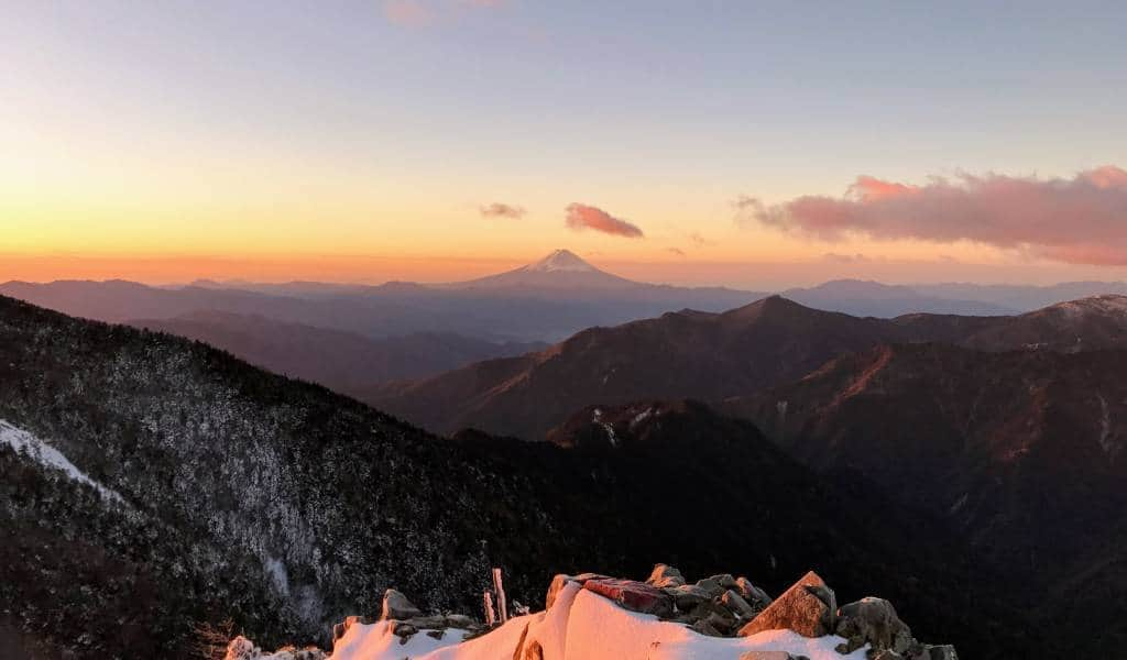
There’s nothing better than getting out into nature. Walking through valleys and up mountains is the perfect way to relax and forget the stresses of big city life. To help you do just that, here’s our compilation of top Tokyo hiking trails, ranging from easy to expert.
Jump to:
- Mt. Kōbō (easy)
- Kinchakuda (easy)
- Mt. Tsukuba (easy)
- Mt. Takao (easy)
- Mt. Nokogiri (easy/enthusiast)
- Mt. Mitake (easy)
- Kamakura (easy)
- Mt. Jinba (easy/enthusiast)
- Mt. Mitsumine (enthusiast)
- Mt. Ōyama (enthusiast)
- Mt. Kawanori (enthusiast)
- Okutama–Mt. Mitake–Mt. Hinode (enthusiast)
- Mt. Kentoku (expert)
- Mt. Kobushigatake (expert)
- Yatsugatake Range (expert)
- What equipment and preparation do I need?
1. Mount Kōbō
- Duration: 2.5 hours
- Skill level: Easy
- Season: All year
For those just looking to dip a toe into the Tokyo hiking scene, Mt. Koubou is an excellent starting point. Set in the foothills south of Mt. Oyama, this easy 2.5-hour hike is especially popular during cherry blossom season, when lanterns illuminate the flowers in the early evening.
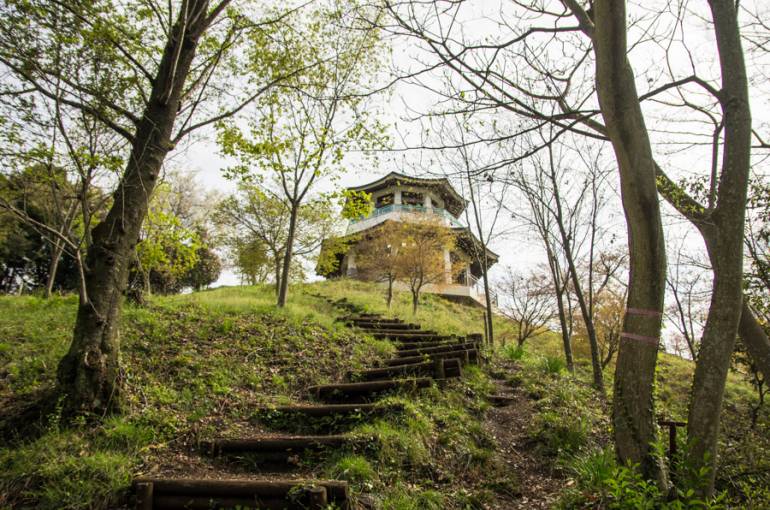
Near the summit you’ll find plenty of picnic tables and benches, and on clear days you can enjoy views toward Mt. Fuji and Sagami Bay. Keen to get going? Here’s a full guide to hiking Mt. Kōbō.
Nearest station: Odakyu Hadano. From the station, turn right and walk along the road for about 20 minutes. The trail commences on your right, a little way up from the 7-Eleven.
2. Kinchakuda
- Duration: 2–3 hours
- Skill level: Easy
- Season: All year
For a gentle ramble, head to Kinchakuda and Hiwada. The trail takes around 2–3 hours and feels more like a country walk than a hike. There’s a bit of a real hike at the end, so you can feel like you’ve earned the view. Along the way is an organic café and even ponies to make it worthwhile. Yes, we said ponies.
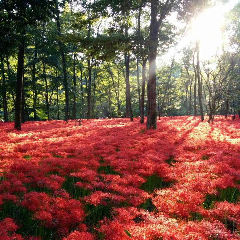
Along the route are waterwheels and, depending on the season, cherry blossoms, red spider lilies and wild flowers. Climbing Mt. Hiwada (the end part) may seem daunting to non-hiker cheapos, but it is actually more of a hill at only 305 m high. From the top, you can enjoy views of Mt. Fuji and Tokyo before heading back down to the main road and either catching the train or walking back the way you came. See our dedicated post on hiking Kinchakuda for more details.
Nearest station: Hanno. Cheapo tip: Take the Seibu-Ikebukuro Line from Ikebukuro — it costs ¥480.
3. Mount Tsukuba
- Duration: 3–4 hours
- Skill level: Easy
- Season: All year
The double-peaked Mt. Tsukuba is one of the most popular climbs near Tokyo offering an easy route and spectacular views of the Kanto Plain. It is one of the top 100 famous mountains in Japan, with a somewhat one-sided rivalry against Mt. Fuji.
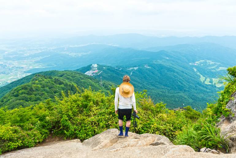
You’ll find a matchmaking shrine perched along the route, reflecting the forever-linked twin peaks of Tsukuba. Although the mountain is only 887 m high, it can still offer some fun challenges — especially on the way down as it gets pretty steep. Many people hike up and then use the ropeway to return, saving their legs and enjoying the view. There are different routes to choose from, and you can enjoy an abandoned theme park on the way up as well as a hot spring. Read our article on hiking Mt. Tsukuba for more information.
Nearest station: Tsukuba. Buses from the station will take you to two different points on the mountain, and leave hourly.
4. Mount Takao
- Duration: 3–4 hours
- Skill level: Easy
- Season: All year
Another popular spot for Tokyoites desperate to escape the city, Mt. Takao has everything you need for a good Japanese hike — a variety of different trails, an unusual shrine, views of Mt. Fuji, monkeys, and a cable-car option too (oh, and packs of extraordinarily fit elderly).
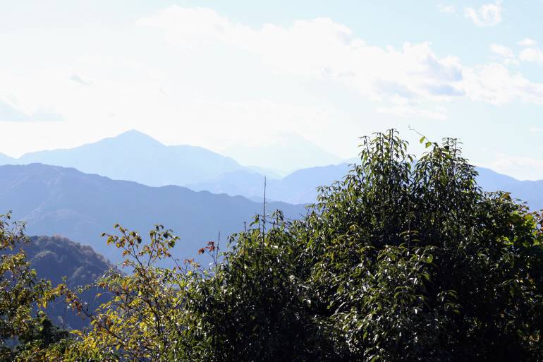
For the simplest hike, Trail Option 1 — the Omotesando Trail — is the best, as it is widely used and takes just 90 minutes from the base. The Kasumidai Loop Trail is also easy, and takes you through the forests. You can try the Biwa Waterfall Trail too, which is about 90 minutes long and follows the stream, with chances to see monks undergoing ascetic training at the waterfalls.
Close to the summit (along Trail 1), you’ll find Yakuōin Shrine, famed for its enshrined mountain gods and crow-beaked tengu. Other attractions to look out for on Mt. Takao include the local monkey park, wild flower garden and Keio Takaosan Onsen Gokurakuyu (with separate baths). Beyond the summit is a network of trails leading to other peaks in the surrounding national park. See Ridgeline Images for more details on hiking Mt. Takao.
You can also join a guided hiking tour and learn about the mountain and its wildlife along the way. Plus, the guide will give you the lowdown on onsen etiquette when you stop by the onsen after your hike.
Nearest station: Keio Takasanguchi. From there, you can hike up the mountain (about 2 hours), or walk to Kiyotaki Station, where you can take a combination of cable cars and colorful open ropeway lifts (ski-lift style) for ¥490 one way, depositing you halfway up the mountain.
5. Mount Nokogiri
- Duration: 3-4 hours
- Skill level: Easy/enthusiast
- Season: All year
People don’t often hike Nokogiriyama, as there is a ropeway and plenty of walking to do at the top. But if you want to boost your step count for the day, there are two trails to the top that are steep but manageable. Both routes (see below) take about 50 minutes and merge at the top near a quarry site. There’s little to separate the two besides a few different sightseeing spots.
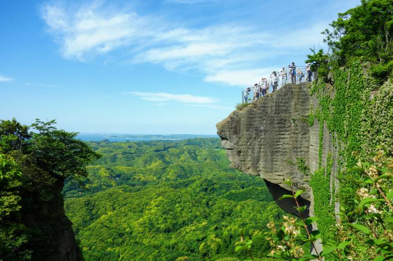
The Sharikimichi route and the Kanto Fureai No Michi route begin at the same place — one with daunting stairs and one without, so that might make your decision for you. Hiking is not the main attraction of the mountain, but it is a beautiful option, with the aforementioned quarry site and abandoned wooden transport structures to see. Be aware that some points on the trail are not clearly marked, so keep an eye on signs highlighted in provided maps. Once you reach the top of the mountain, you basically continue trekking from the giant Buddha to hundreds of smaller Buddhas and the temple to the Kannon — so there’s no rest for the wicked! Read more about hiking Mt Nokogiri.
If you’re keen to hike the whole way, but don’t want to risk getting lost you can join a hiking tour.
Nearest station: Hamakanaya. The ropeway and hiking trails are a short walk from the station if you are arriving from Tokyo. From the Yokohama area, you can travel to Keikyu-Kurihama Station, get a bus to the port, then ferry to the mountain base.
6. Mount Mitake
- Duration: 3–4 hours
- Skill level: Easy
- Season: All year (you may need crampons for winter snow)
Located in Ōme City, Tokyo, Mt. Mitake is the home to Mitake Shrine, a famous destination for pilgrims and a place with a 2000-year history. With dozens of species of birds, splendid flowers, and clear streams and waterfalls, Mitake is a naturalist’s delight. City dwellers that are familiar with the Tama River probably don’t want to swim in it, but here in the Okutama region, the water flows clear and is perfect for a dip to rinse off some of the sweat you’ve worked up on the trail.
There is a cable car, but if you decide to hike, it’s a good bit of excercise with about a 60-minute walk up from the valley to Mitake Shrine. You can then walk for another hour to reach the beautiful “Rock Garden” — a forest valley with a stream, moss-carpeted rocks and waterfalls.
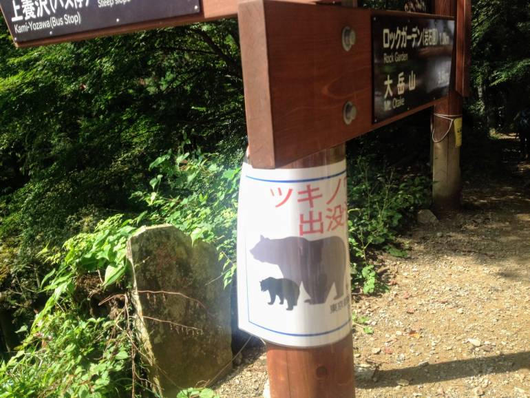
From there, it’s another hour or so to the summit of Mt. Otake, with various hiking trails to other viewpoints and mountains. There is a visitor center between then ropeway and the shrine, with maps for the different trails (note: it is closed on Mondays). For a longer expedition, see the Okutama–Mt. Mitake–Mt. Hinode (enthusiast) hike below.
Nearest station: JR Mitake. The station is on the Ōme Line, a branch of the Chūō Line from Shinjuku. On weekends, there’s a couple of direct rapid trains, called Holiday Rapid Okutama, going all the way to Mitake Station. Then take the bus or alternatively walk west along the river until you find the sign and bridge to Mt. Mitake. From there, rejoin the road heading into the mountain marked by a red “torii” (the big wooden gateway often found at shrine entrances). After a few minutes of walking up hill, you’ll reach the Mitake Tozan Ropeway Station. Or if you’re up for the excercise, the trail continues up the steep narrow road along side the tracks.
7. Kamakura trails
- Duration: 30-90 minutes each
- Skill level: Easy
- Season: All year
If steep mountains are not your style, Kamakura has some great low key options that still get you out in nature. There are three main routes to choose from — the Western Daibutsu Hiking Course, the Northern Tenen Hiking Course and the Eastern Gionyama Hiking Course. These courses are quite leisurely and will take you past many of the main attractions in Kamakura, including the Giant Buddha and several temples.
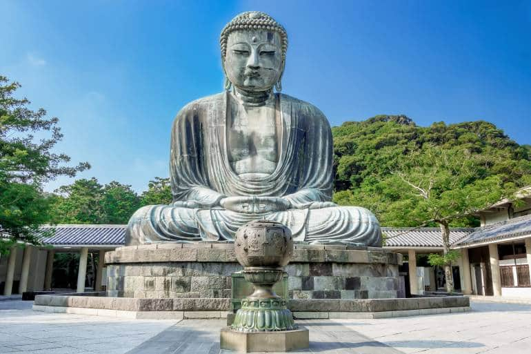
The Daibutsu Hiking Course and Tenen Hiking Course each take 60-90, while the Gionyama Hiking Course is a shorter 30 minutes. It’s quite feasible to do all three course in one day and still have time to head down to the beach to cool off. Or you could hop on over to Enoshima instead and treat yourself to a dip in an onsen.
For more information about the Kamakura hiking trails, check out our article here.
Note:The Gionyama Hiking Course is currently closed due to typhoon damage.
Nearest station: JR Kamakura Station. From here follow the signs for the trail you’d like to start with.
8. Mount Jinba
- Distance: 7-8 hours (depending on route)
- Duration: 8 hours hiking
- Skill level: Easy/enthusiast (need stamina for the full route)
- Season: All year (crampons required in the winter in case of snow)
Mt. Jinba, while a low-altitude peak (854 m), offers some of the best views in the Kanto area. On a clear winter day from the summit, you’ll be able to see Mt. Fuji and the Japanese Alps in one direction, with Tokyo and Mt. Tsukuba in the other — that’s a view extending almost 100 km both directions. It’s a popular route, and you will encounter plenty of other friendly hikers on your way.
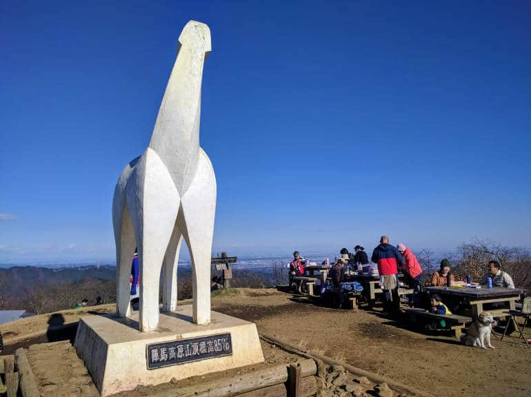
While you have the option of cutting this hike short, the full route takes you along a pleasant and fairly open hike along the ridges between Mt. Jinba and Mt. Takao. There’s a few mountain teahouses along the way where you can stop for some soba or mountain hut fare.
You can reach the trailhead from JR Fujino Station. On the way back, there are two options: 1) Leave the trail at the summit of Mt. Jimba to take a bus back to Hachioji, or 2) Trek the full route, which ends at the cable car/chair lift on Mt. Takao.
Read our full article on hiking Mt. Jimba.
Nearest station: JR Fujino. Follow the signs through the tunnel under the railway and continue along the road for 30 minutes until you reach the trailhead signposted for Mt. Jinba.
9. Mount Mitsumine
- Duration: 5 hours
- Skill level: Enthusiast
- Season: All year (you may need crampons for winter snow)
The Saitama side of the Chichibu-Tama-Kai Park is home to Mt. Mitsumine and Lake Chichibu, which means superb hiking and beautiful lake views! The course includes breathtaking vistas from suspension bridges to the 2000-year-old Mitsumine shrine — plus plenty of mountain huts for hikers and campers.
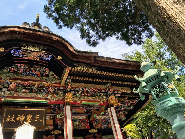
The full trail takes about 5 hours with time for gazing at views. There aren’t many places to eat — so you should bring your own lunch.
Nearest station: Mitsumine-Guchi. Take a bus from there to the Owa stop. On your return, you can take the bus from the lake all the way to the station.
10. Mount Ōyama
- Duration: 5-6 hours
- Skill level: Enthusiast
- Season: All year (you may need crampons for winter snow)
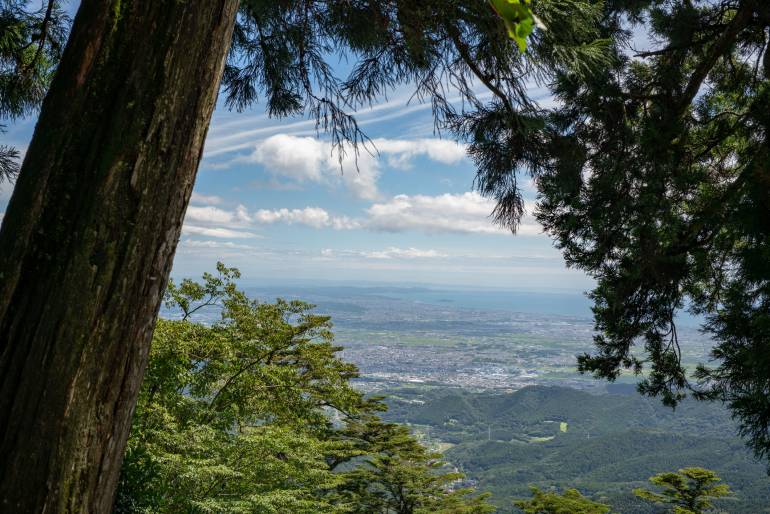
One of Tokyo’s top 50 scenic sites, Mt. Ōyama gets better the higher you climb. There are a variety of different routes, so you can choose your difficulty level (including the option to just ride the cable car and enjoy the views).
Assuming you do want to trek though and are looking for a Tokyo hiking challenge, you can choose either the Yabitsu-Toge Pass or the Otoko-zaka Trail for some serious leg burn. Mt. Ōyama has an awesome shrine and temple to see and is also famous for tofu — so you’ll see some tofu restaurants on the initial ascent to the ropeway (which is where the trails begin).
The Onna-zaka (women’s trail) is shorter than the Otoko-zaka (men’s trail), so if you feel like proving a point, this is an added bonus. However, the women’s trail does pass by “Seven Wonders”, so there’s a bonus for us “weak and frail” sorts. Once you reach the Ōyama Afuri Shrine, you can follow signs for the Shimosha Trail to the main shrine and summit (although it is closed from February to April). Here are more details on the Mt. Ōyama hike.
Nearest station: Isehara. From the station, you can catch a bus to the start of the trails. There is an information centre with maps at the station too.
11. Mount Kawanori
- Duration: 5–6 hours
- Skill level: Enthusiast
- Season: All year (you may need crampons for winter snow)
A step up in the hiking stakes introduces Mt. Kawanori, which can be climbed year-round — but be prepared for snow in the winter.
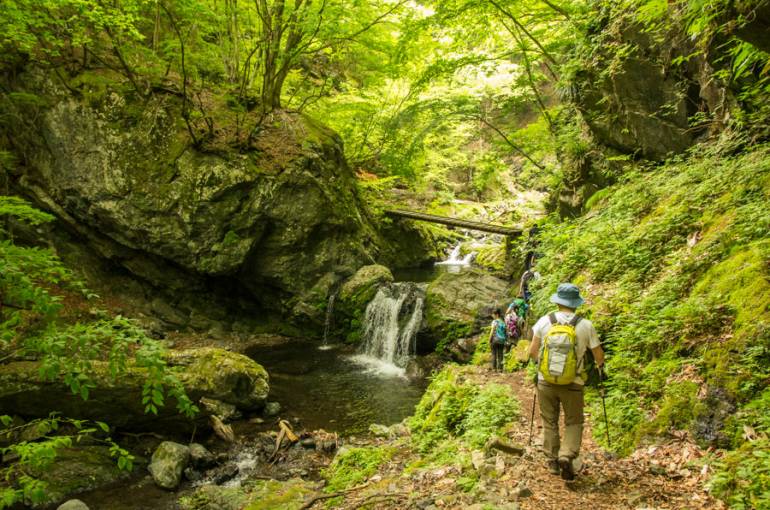
The hike has some risky sections, so you need to watch your footwork. The first rest station can be reached after about 35 minutes. After a rather precarious path, which rises above the river, you arrive at the towering Hyakuhiro Waterfall. From here on, it’s an unyielding 100-minute climb to the summit, an excellent spot to roll out the picnic mat and bask in the natural surroundings. On this ascent, there are some ropes added for support, and a fork in the road allows you to choose a tougher trail (straight ahead) or a better-maintained trail (to your left) on your way to the summit. Find out more about hiking Mt. Kawanori.
Nearest station: JR Okutama. From there, it’s a 15-minute bus ride to the Kawanori-bashi bus stop, where the trail starts.
12. Okutama–Mt. Mitake–Mt. Hinode
- Duration: 7–8 hours
- Skill level: Enthusiast (requires stamina)
- Season: All year (you may need crampons for winter snow)
If one mountain isn’t enough for you, then why not climb three in a day? This three-peak hike is not as crazy as it sounds, and the views are definitely worth it. Combining Mt. Nokogiri, Mt. Ōtake (aka Ōdake) and Mt. Mitake, the hike has a steep start, but once you reach the ridge, it is pretty easy.
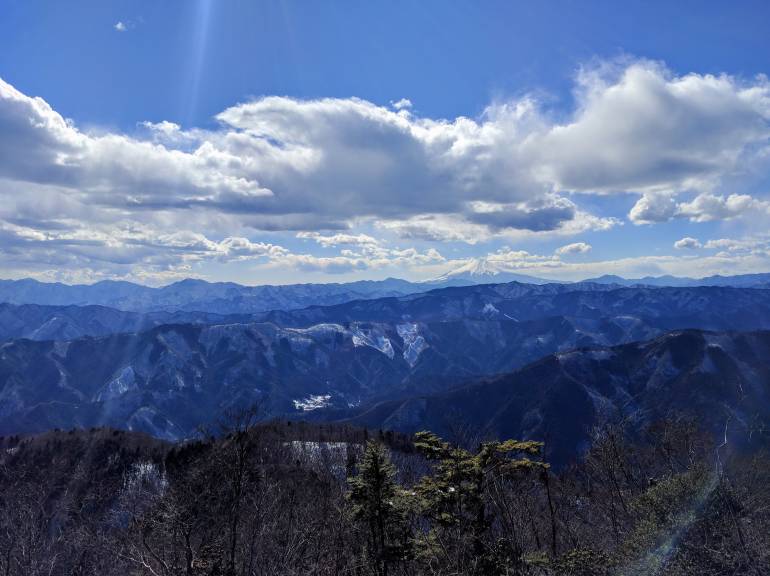
There is some clambering, and you do need to be in pretty good shape to make it. Plus in the winter, there is likely to be snow. If climbing in the winter, it’s advisable to bring crampons — and setting off early is a must, since it will get dark around 5 pm.
Along the route are shrines, cedar forests and incredible views of Mt. Fuji (if you’re lucky) from Mt. Ōtake. If you fancy it, you can hike an extra 2 hours to Tsuru-tsuru Onsen to soak your legs, or continue to Mitake and catch the ropeway down instead. See more about this three-day feat of Tokyo hiking here.
Nearest station: JR Okutama. Leave the station and turn left, then cross the bridge over the Tama River and enter the forest path on the right-hand side of the road. Follow the signs for Mt. Nokogiri (鋸山) and Mt. Ōtake (大岳山). Make a note of the kanji, as the signs often lack English.
13. Mount Kentoku
- Duration: 8–10 hours
- Skill level: Expert (requires stamina)
- Season: Late spring to late autumn (snow-capped all winter)
If you’re up for a challenge, look no further than Mt. Kentoku in Yamanashi Prefecture. The hike first passes by the Kougen Hut, which is set on a delightful plateau with plenty of sika deer milling about to keep you company.
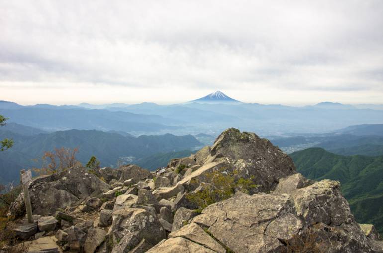
You can manage this hike in a day or spend the night at the Kōgen Hut plateau, which has a campsite as well as sleeping spaces indoors. It is not a hostel though; the hut is unsupervised. From there, getting to the summit of Mt. Kentoku takes a little over 90 minutes. For those game enough, just below the peak is a sheer rock precipice, which can be tackled via a long chain. You can either hike a steeper route down the other side of the mountain or return the same way. For more details on this awesome hike, see this post.
Nearest station: JR Enzan. If you’re planning to complete this hike as a day trip, make sure you’re on an early train as Enzan Station is 2.5 hours by local train from Shinjuku. From the station, you have a choice of either jumping on a bus bound for Nishizawa Gorge or forking out for a 20-minute taxi ride.
14. Mount Koboshigatake
- Duration: 2 days
- Skill level: Expert (requires stamina)
- Season: Late spring to late autumn (snow-capped all winter)
This mountain is an alternative to nearby Mt. Kentoku, boasting the same spectacular views with Mt. Fuji in the distance. The trail is similiarly steep and long, but there’s a well-equipped mountain lodge just below the summit that stays open till late November, so you can travel lighter and hike farther if you use the board and lodge facilities there.
While the journey is still possible as a day trip from Tokyo with a very early start and if you don’t rely on the bus timetable, it makes for a good overnight trip, as you can continue along the Karisaka ridge on day two, enjoying extensive 360-degree views over much of Kanto and central Japan. Read our full article on the Mt. Kobushi to Karisaka Pass hike.
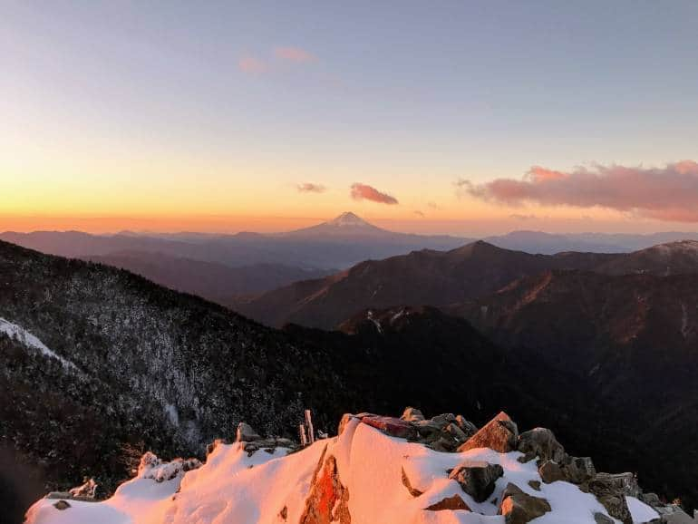
Nearest station: JR Enzan. Take the bus to Nishizawa Gorge — the trail starts a few minutes’ walk from the last stop. Don’t forget crampons if you’re hiking in late autumn or late spring as deep snow is likely.
15. Yatsugatake Mountain Range
- Duration: 1-3 days
- Skill level: Expert (requires stamina)
- Season: Late spring to late autumn (snow-capped all winter)
Last but not least, Yatsugatake is a stand-alone eight-peak volcanic ridge located 3 hours from Tokyo by car. The views from the peaks and most of the ridge are incredible with uninterrupted views in every direction. The highest peak Akadake, at 2899m tall, is one of Japan’s 100 famous mountains, but the whole mountain range makes for great ridge hiking as the numerous mountain lodges at which you can stay or eat simplify multi-day trip planning.
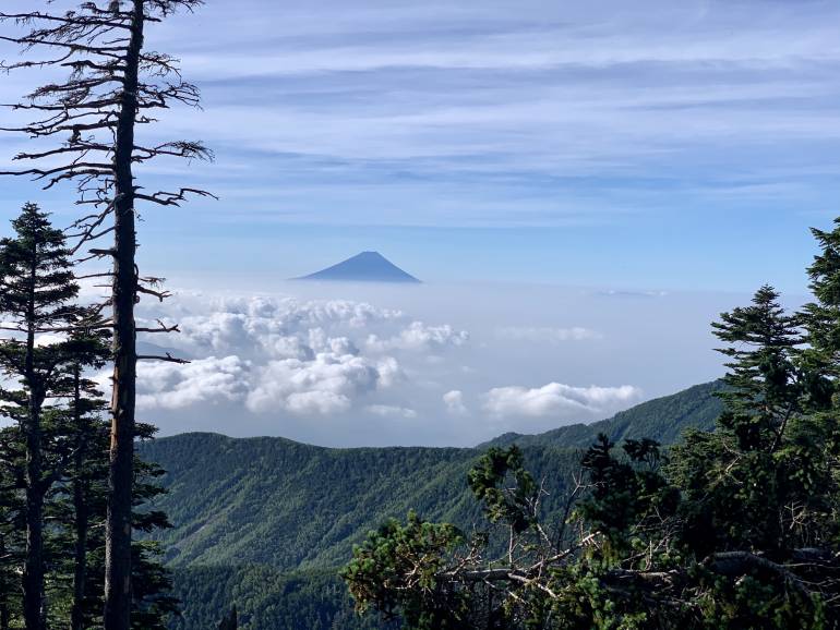
Nearest station: Chino (Nagano). You can take the same JR Express train from Shinjuku as for Mt. Kentoku and stay on a few extra stops from Enzan. From the station there are several buses to various starting trails. If you’re going for Akadake, take the bus headed to Minotoguchi (美濃戸口).
Read our full guide on Yatugatake here.
What preparation and equipment do I need?
For the easier hikes in this article, food and drink along with good walking shoes (and crampons if there’s snow) and waterproof clothing should cover most of the preparation you might need. Depending on the route, you may be able to pick up snacks/lunch at a mountain lodge, but it’s always sensible to have some supplies. For maps, the Yamap app (for iOS or Android) has free and paid maps that you can download and use offline. You can even follow your current location using smartphone GPS services.
For the longer and harder routes mentioned here, you should only be attempting these if you are experienced or have an experienced hiker in your group. Do bear in mind that mountains above 2000m will be snow-capped all winter, and depending on recent conditions, the lower altitude hikes might also require crampons. If you need to pick up any gear, Tokyo is a great place for outdoor shopping. Here’s where you can find hiking gear in Tokyo.
You should consider mountain rescue insurance (we recommend using the Yamap app, via which you can buy mountain rescue cover cheaply). For visitors, this may be covered in your travel insurance. For people living in Japan, note that mountain rescue isn’t included in the national health insurance — it costs 1.4 million yen for a resuce helicopter.
Special thanks to David at Ridgeline Images for helping us with some of the hiking spots and images in this post. For all your Tokyo hiking needs, check them out here.
See also:
- Japan Hikes Blog – Kanto section
- Times Car Plus – Affordable Car Sharing for City Dwellers (a handy way to get to the remote locales)
While we do our best to ensure it’s correct, information is subject to change. Post first published in August 2017. Last updated in September 2022 by Maria Danuco.

